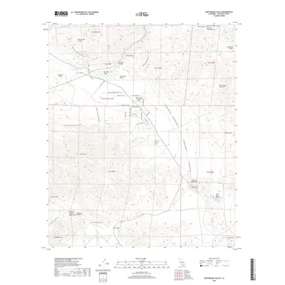
2018 Map of Earthquake Valley
USGS Topo · Published 2018About this map
Earthquake Valley and San Felipe Valley serve as the central corridors for this high desert landscape, defined by a complex web of historic routes and modern trails. The map preserves the alignment of the Stage Coach Trl and Wells Fargo Trl, tracing the path of 19th-century transit through Foot and Walker Pass. These historic thoroughfares are intersected by the Pacific Crest National Scenic Trail and the CA Riding & Hiking Trail, which wind through the foothills of Granite Mtn and Grapevine Mtn.
Find a feature on this map
52 named features on this map. Tap any name to fly to it.
Don’t see what you’re looking for? This feature index may not catch every label — zoom into the map to look around manually.
Map Details
Editions of this 2018 Earthquake Valley Map
This is the sole edition of this map. No revisions or reprints were ever made.
Other maps of this area

1903 · Cuyamaca
USGS Topo · 1:125,000

1903 · Ramona
USGS Topo · 1:125,000

1904 · Southern California Sheet No. 2
USGS Topo · 1:250,000

1931 · Vallecito
USGS Topo · 1:125,000

1931 · Carrizo
USGS Topo · 1:125,000

1939 · Santa Ysabel
USGS Topo · 1:62,500

1939 · Borrego
USGS Topo · 1:62,500

1942 · Borego
USGS Topo · 1:62,500

1942 · Cuyapaipe
USGS Topo · 1:62,500

1942 · Cuyamaca Peak
USGS Topo · 1:62,500