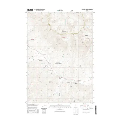
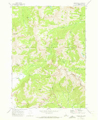
2013 Map of Easley Hot Springs
USGS Topo · Published 2013About this map
Easley Hot Springs and the neighboring community of Cathedral Pines occupy the high-altitude valley floor where the Big Wood River parallels State Hwy 75. This 2013 topographic survey highlights the rugged intersection of the Sawtooth National Forest and the Boulder Mountains. The landscape is defined by steep glacial features and narrow drainage corridors such as Easley Gulch and Logged Canyon. Recreation and seasonal settlement are central to the area's character, evidenced by the Central Idaho Camp, Prairie Campground, and Baker Creek Campground. At higher elevations, the map records alpine hydrology including Silver Lake, Window Lake, and the Boulder Lakes, tucked beneath prominent summits like Easley Peak and Silver Peak. The eastern portion of the sheet captures the remote Boulder Basin and the settlement of Boulder, marking the transition between Blaine County and Custer County.
Find a feature on this map
52 named features on this map. Tap any name to fly to it.
Don’t see what you’re looking for? This feature index may not catch every label — zoom into the map to look around manually.
Map Details
Editions of this 2013 Easley Hot Springs Map
This is the sole edition of this map. No revisions or reprints were ever made.
Other maps of this area

1895 · Hailey
USGS Topo · 1:125,000

1897 · Hailey
USGS Topo · 1:125,000

1900 · Sawtooth
USGS Topo · 1:125,000

1955 · Hailey
USGS Topo · 1:250,000

1959 · Hailey
USGS Topo · 1:250,000

1962 · Hailey
USGS Topo · 1:250,000
1967 · Griffin Butte
USGS Topo · 1:24,000
1967 · Amber Lakes
USGS Topo · 1:24,000
1967 · Ryan Peak
USGS Topo · 1:24,000
1970 · Horton Peak
USGS Topo · 1:24,000