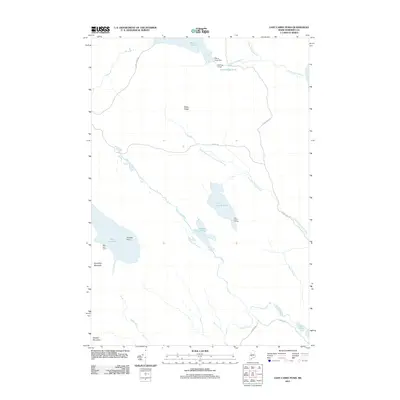
2011 Map of East Carry Pond
USGS Topo · Published 2011About this map
Pierce Pond Dam stands at the northern edge of this Somerset County landscape, where the waters of Pierce Pond begin their descent toward the Kennebec River. This area is defined by the historic portage route between the river and the Dead River watershed, reflected in the names of the North Branch Carrying Place Stream and Carrying Place Stream. These waterways, along with the trio of East Carry Pond, Middle Carry Pond, and West Carry Pond, illustrate a long-standing recreational and wilderness corridor in Maine. Local encampments such as Sterlings Camps, East Carry Camps, and West Carry Camp are situated along these shorelines, suggesting a continuing tradition of sporting camps and seasonal residency. High points like Roundtop Mountain and Stewart Mountain anchor the southern terrain, while Bates Ridge divides the central drainage basins, providing a clear view of the natural and lightly developed character of the Maine woods in the early 21st century.
Find a feature on this map
30 named features on this map. Tap any name to fly to it.
Don’t see what you’re looking for? This feature index may not catch every label — zoom into the map to look around manually.
Map Details
Editions of this 2011 East Carry Pond Map
This is the sole edition of this map. No revisions or reprints were ever made.
Other maps of this area

1903 · Bingham
USGS Topo · 1:62,500

1905 · Bingham
USGS Topo · 1:62,500

1905 · The Forks
USGS Topo · 1:62,500

1907 · The Forks
USGS Topo · 1:62,500

1925 · Pierce Pond
USGS Topo · 1:48,000

1927 · Pierce Pond
USGS Topo · 1:62,500

1928 · Dead River
USGS Topo · 1:62,500

1931 · Dead River
USGS Topo · 1:48,000

1944 · Dead River
USGS Topo · 1:62,500

1944 · Pierce Pond
USGS Topo · 1:62,500
Featured Places
- Pleasant Ridge Plantation, ME
- Caratunk, ME
- Highland Plantation, ME
- Bowtown Township, ME
- Carrying Place Township, ME