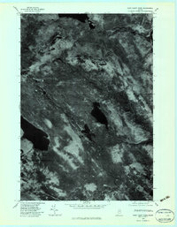
1979 Map of East Carry Pond
USGS Topo · Published 1983About this map
East Carry Pond and West Carry Pond dominate this Somerset County landscape, which was documented through high-altitude aerial photography in the late 1970s. The terrain is defined by the prominent Bates Ridge and the Kennebec River, which cuts along the eastern edge of the quadrangle. A notable geographic feature is the Carrying Place, reflecting the historic portage routes through this wooded region of Maine. Drainage for the area is managed by several waterways, including the winding path of Sandy Stream and the southern flow of Barker Brook. This orthophotoquad provides an unfiltered view of the forest canopy and water bodies, offering researchers a precise look at the land cover and hydrology before modern development or significant forest management changes altered these remote shorelines.
Find a feature on this map
7 named features on this map. Tap any name to fly to it.
Don’t see what you’re looking for? This feature index may not catch every label — zoom into the map to look around manually.
Map Details
Editions of this 1979 East Carry Pond Map
This is the sole edition of this map. No revisions or reprints were ever made.
Other maps of this area

1903 · Bingham
USGS Topo · 1:62,500

1905 · Bingham
USGS Topo · 1:62,500

1905 · The Forks
USGS Topo · 1:62,500

1907 · The Forks
USGS Topo · 1:62,500

1925 · Pierce Pond
USGS Topo · 1:48,000

1927 · Pierce Pond
USGS Topo · 1:62,500

1928 · Dead River
USGS Topo · 1:62,500

1931 · Dead River
USGS Topo · 1:48,000

1944 · Dead River
USGS Topo · 1:62,500

1944 · Pierce Pond
USGS Topo · 1:62,500
Featured Places
- Pleasant Ridge Plantation, ME
- Caratunk, ME
- Highland Plantation, ME
- Bowtown Township, ME
- Carrying Place Town Township, ME