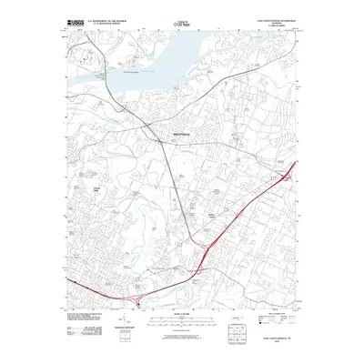
2010 Map of East Chattanooga
USGS Topo · Published 2010About this map
Chickamauga Lake dominates the northern reaches of this landscape, held back by the Chickamauga Dam and crossed by the Wilkes T Thrasher Bridge. The area is a dense tapestry of suburban growth and historical landmarks, where settlements like Brentwood, Forest Hills, and Hickory Valley are interspersed with numerous family and memorial burial grounds. Genealogists will find a wealth of data in the locations of the Brainerd Mission Cemetery, Confederate Cemetery, and Varnell Cemetery.
Find a feature on this map
87 named features on this map. Tap any name to fly to it.
Don’t see what you’re looking for? This feature index may not catch every label — zoom into the map to look around manually.
Map Details
Editions of this 2010 East Chattanooga Map
This is the sole edition of this map. No revisions or reprints were ever made.
Other maps of this area

1886 · Ringgold
USGS Topo · 1:125,000

1888 · Chattanooga
USGS Topo · 1:125,000

1892 · Ringgold
USGS Topo · 1:125,000

1893 · Chattanooga
USGS Topo · 1:125,000

1935 · East Chattanooga
USGS Topo · 1:24,000

1935 · Daisy
USGS Topo · 1:24,000

1935 · East Ridge
USGS Topo · 1:24,000

1935 · Ringgold
USGS Topo · 1:24,000

1935 · Snow Hill
USGS Topo · 1:24,000

1935 · Ooltewah
USGS Topo · 1:24,000