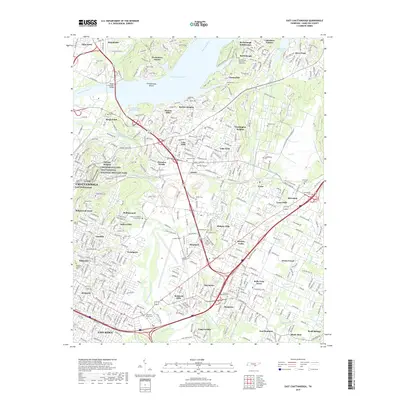
2019 Map of East Chattanooga
USGS Topo · Published 2019About this map
Chickamauga and Chattanooga National Military Park highlights the historical significance of this landscape, where the terrain of Missionary Ridge and the Tennessee River shaped local development. The map reveals a dense network of suburban expansion and historical sites, including several cemeteries of interest to genealogists such as the Brainerd Mission Cem and the Confederate Cem near Silverdale. Residential neighborhoods like Kings Point, Shepherd, and Tyner are established alongside major infrastructure like the Wilkes T Thrasher Bridge crossing Chickamauga Lake. Industrial and transport patterns are visible through features like the Wilcox Tunnel and the various branches of the South Chickamauga Creek, reflecting how the city's geography continues to be defined by its proximity to the shoals and ridges that once dictated military strategy.
Find a feature on this map
82 named features on this map. Tap any name to fly to it.
Don’t see what you’re looking for? This feature index may not catch every label — zoom into the map to look around manually.
Map Details
Editions of this 2019 East Chattanooga Map
This is the sole edition of this map. No revisions or reprints were ever made.
Other maps of this area

1886 · Ringgold
USGS Topo · 1:125,000

1888 · Chattanooga
USGS Topo · 1:125,000

1892 · Ringgold
USGS Topo · 1:125,000

1893 · Chattanooga
USGS Topo · 1:125,000

1935 · East Chattanooga
USGS Topo · 1:24,000

1935 · Daisy
USGS Topo · 1:24,000

1935 · East Ridge
USGS Topo · 1:24,000

1935 · Ringgold
USGS Topo · 1:24,000

1935 · Snow Hill
USGS Topo · 1:24,000

1935 · Ooltewah
USGS Topo · 1:24,000