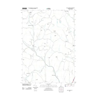
2012 Map of East Corinth
USGS Topo · Published 2012About this map
East Corinth and East Topsham anchor this landscape in Orange County, where the Waits River and numerous mountain streams carve through the upland terrain. The map reveals a dense network of family history through its many burial grounds, including the Avery Family Cem and Mills Family Cem. Small settlements like Goshen and Bradford Center are linked by backroads such as Swamp Rd and Old Stage Coach Rd, reflecting a rural architecture focused on agriculture and timber. Prominent elevations like Wrights Mountain and Woodchuck Mountain dominate the central topography, while Halls Lake and Round Pond provide significant water features in the eastern hills. The presence of numerous named peaks and brooks, such as Iras Pinnacle and Roaring Brook, illustrates a region where geography and early settlement are deeply intertwined.
Find a feature on this map
131 named features on this map. Tap any name to fly to it.
Don’t see what you’re looking for? This feature index may not catch every label — zoom into the map to look around manually.
Map Details
Editions of this 2012 East Corinth Map
This is the sole edition of this map. No revisions or reprints were ever made.
Other maps of this area

1896 · Strafford
USGS Topo · 1:62,500

1931 · Mt. Cube
USGS Topo · 1:62,500

1931 · Woodsville
USGS Topo · 1:48,000

1933 · Mt. Cube
USGS Topo · 1:62,500

1935 · Woodsville
USGS Topo · 1:62,500

1941 · Woodsville
USGS Topo · 1:62,500

1944 · Strafford
USGS Topo · 1:62,500

1947 · Corinth
USGS Topo · 1:62,500

1948 · East Barre
USGS Topo · 1:62,500

1950 · Glens Falls
USGS Topo · 1:250,000