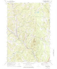
1973 Map of East Corinth
USGS Topo · Published 1975About this map
Waits River carves a deep valley through this Orange County landscape, anchoring a network of small settlements and upland farms in the early 1970s. The village of East Corinth sits at the confluence with Tabor Branch, while South Corinth and Bradford Center mark the southern reaches of the quadrangle. This era shows the persistence of traditional Vermont land use, where local Quarry sites are tucked near the riverbanks and narrow roads like Pike Hill Road climb toward the high ground of Wrights Mtn and Tucker Mtn.
Find a feature on this map
51 named features on this map. Tap any name to fly to it.
Don’t see what you’re looking for? This feature index may not catch every label — zoom into the map to look around manually.
Map Details
Editions of this 1973 East Corinth Map
This is the sole edition of this map. No revisions or reprints were ever made.
Other maps of this area

1896 · Strafford
USGS Topo · 1:62,500

1931 · Mt. Cube
USGS Topo · 1:62,500

1931 · Woodsville
USGS Topo · 1:48,000

1933 · Mt. Cube
USGS Topo · 1:62,500

1935 · Woodsville
USGS Topo · 1:62,500

1941 · Woodsville
USGS Topo · 1:62,500

1944 · Strafford
USGS Topo · 1:62,500

1947 · Corinth
USGS Topo · 1:62,500

1948 · East Barre
USGS Topo · 1:62,500

1950 · Glens Falls
USGS Topo · 1:250,000