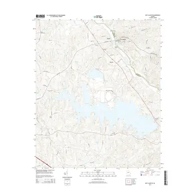
2014 Map of East Juliette
USGS Topo · Published 2014About this map
The Ocmulgee River carves through the landscape of the Georgia Piedmont, serving as the boundary between Monroe and Jones Counties. This region is centered around the settlements of Juliette, East Juliette, and Percale, where river crossings and local agriculture shaped the community structure for generations. Notable river features include Bridges Island and Zellner Island, while the confluence of the Tawaliga River and various creeks like Berry Cr and Rum Cr define the local drainage patterns. Large bodies of water, including Williams Lake and Hicks Lake, are prominent landmarks in the central and southern portions of the territory.
Find a feature on this map
72 named features on this map. Tap any name to fly to it.
Don’t see what you’re looking for? This feature index may not catch every label — zoom into the map to look around manually.
Map Details
Editions of this 2014 East Juliette Map
This is the sole edition of this map. No revisions or reprints were ever made.
Other maps of this area

1951 · Forsyth
USGS Topo · 1:62,500

1953 · Athens
USGS Topo · 1:250,000

1956 · Bolingbroke
USGS Topo · 1:62,500

1956 · Macon
USGS Topo · 1:62,500

1957 · Macon
USGS Topo · 1:250,000

1958 · Macon
USGS Topo · 1:250,000

1958 · Athens
USGS Topo · 1:250,000

1959 · Athens
USGS Topo · 1:250,000

1963 · Athens
USGS Topo · 1:250,000

1964 · Macon
USGS Topo · 1:250,000