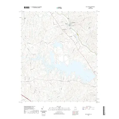
2020 Map of East Juliette
USGS Topo · Published 2020About this map
The Ocmulgee River and Towaliga River converge near the small community of Juliette, a landscape defined by its river-crossing history and the modern footprint of the Rum Creek impoundment. This area, spanning the border of Monroe Co and Jones Co, features the settlement of East Juliette and the locality of Percale. The map documents a blend of communal history and industrial infrastructure, ranging from the Jerry Wadley Memorial Bridge to the Juliette United Methodist Church. Genealogists will find several burial grounds noted, including Ebenezer Cem, Holly Grove Cem, and Saint Peters Rock Cem. The presence of the Georgia Power Company Rd indicates the area's role in regional power generation, while the numerous islands such as Bridges Island and Zellner Island highlight the shifting terrain of the central Georgia river system.
Find a feature on this map
76 named features on this map. Tap any name to fly to it.
Don’t see what you’re looking for? This feature index may not catch every label — zoom into the map to look around manually.
Map Details
Editions of this 2020 East Juliette Map
This is the sole edition of this map. No revisions or reprints were ever made.
Other maps of this area

1951 · Forsyth
USGS Topo · 1:62,500

1953 · Athens
USGS Topo · 1:250,000

1956 · Bolingbroke
USGS Topo · 1:62,500

1956 · Macon
USGS Topo · 1:62,500

1957 · Macon
USGS Topo · 1:250,000

1958 · Macon
USGS Topo · 1:250,000

1958 · Athens
USGS Topo · 1:250,000

1959 · Athens
USGS Topo · 1:250,000

1963 · Athens
USGS Topo · 1:250,000

1964 · Macon
USGS Topo · 1:250,000