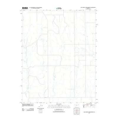
2012 Map of East Kiowa Creek North
USGS Topo · Published 2012About this map
The upper reaches of the Kiowa Creek drainage system dominate this section of the Kansas High Plains. Fed by seasonal tributaries including Middle Kiowa Cr and Wiggins Cr, the landscape is defined by the subtle topography of the Great Plains, where watercourses carve gentle paths through agricultural and grazing lands. The hydrology of the area is further characterized by E Kiowa Cr and Mule Cr, which serve as the primary drainage features for this rural landscape. Evidence of the township's section-line grid is visible in the alignment of rural routes such as Coline Rd, illustrating the systematic land division that defines the region's development. This map provides a technical view of the environmental and infrastructure layout of the township during the early twenty-first century.
Find a feature on this map
5 named features on this map. Tap any name to fly to it.
Don’t see what you’re looking for? This feature index may not catch every label — zoom into the map to look around manually.
Map Details
Editions of this 2012 East Kiowa Creek North Map
This is the sole edition of this map. No revisions or reprints were ever made.
Other maps of this area

1889 · Kinsley
USGS Topo · 1:125,000

1892 · Kinsley
USGS Topo · 1:125,000

1892 · Spearville
USGS Topo · 1:125,000

1892 · Coldwater
USGS Topo · 1:125,000

1894 · Spearville
USGS Topo · 1:125,000

1894 · Kinsley
USGS Topo · 1:125,000

1896 · Ashland
USGS Topo · 1:125,000

1955 · Pratt
USGS Topo · 1:250,000

1959 · Pratt
USGS Topo · 1:250,000

1969 · Bucklin SE
USGS Topo · 1:24,000