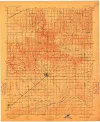
1896 Map of Ashland
USGS Topo · Published 1896About this map
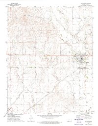
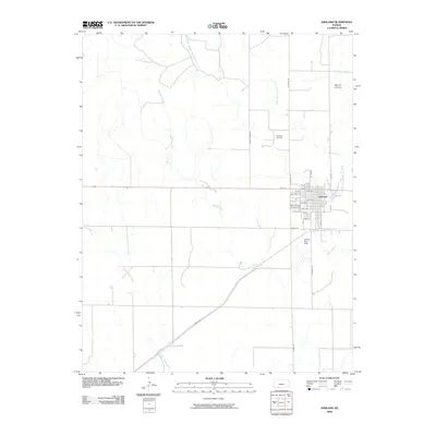
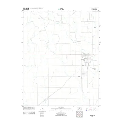
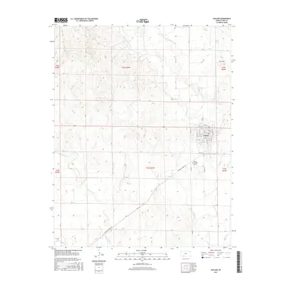
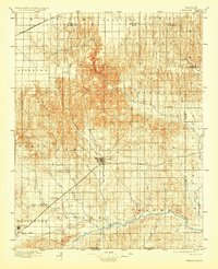
Ashland serves as the central hub of this 1890s Clark County landscape, where the Atchison Topeka and Santa Fe R. R. cuts a diagonal path toward the southwest corner at Englewood. The terrain is defined by a dense network of drainage systems flowing toward the Cimarron River in the south, including Big Sandy Creek and Snake Creek. To the north, the Chicago Rock Island and Pacific R. R. passes through Bloom, marking the edge of the high plains before the ground breaks into the more complex topography surrounding Mt. Jesus. This era of settlement is captured just as small outposts like Sitka and Manning were established along the rail lines. Notable landmarks such as Jacobs Well and Curtis Lake provide specific points of interest for those tracing the early water sources and pioneering routes through this portion of Kansas.
Find a feature on this map
49 named features on this map. Tap any name to fly to it.
Don’t see what you’re looking for? This feature index may not catch every label — zoom into the map to look around manually.
Map Details
Editions of this 1896 Ashland Map
3 editions found
Historical Maps of Ashland Through Time
7 maps found