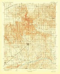
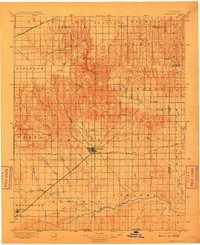
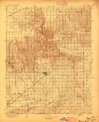
1896 Map of Ashland
USGS Topo · Published 1930About this map
The High Plains of southwest Kansas are defined here by a transition from the rolling drainage of the Cimarron River to the complex canyon systems of the north. The Atchison Topeka and Santa Fe R.R. bisects the county, serving as the primary lifeline for the livestock and agricultural centers of Ashland and Englewood. This 1890s-era survey reveals a landscape where water and rail dictated survival, with isolated landmarks like St Jacobs Well and Mt Jesus rising from the plains.
Find a feature on this map
51 named features on this map. Tap any name to fly to it.
Don’t see what you’re looking for? This feature index may not catch every label — zoom into the map to look around manually.
Map Details
Editions of this 1896 Ashland Map
3 editions found
Other maps of this area

1889 · Kinsley
USGS Topo · 1:125,000

1892 · Kinsley
USGS Topo · 1:125,000

1892 · Meade
USGS Topo · 1:125,000

1892 · Dodge
USGS Topo · 1:125,000

1892 · Spearville
USGS Topo · 1:125,000

1892 · Coldwater
USGS Topo · 1:125,000

1894 · Spearville
USGS Topo · 1:125,000

1894 · Kinsley
USGS Topo · 1:125,000
1894 · Sitka
USGS Topo · 1:62,500
1896 · Ashland
USGS Topo · 1:125,000