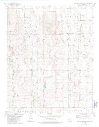
1979 Map of East Kiowa Creek North
USGS Topo · Published 1980About this map
The Old Indian Treaty Boundary strikes across the central portion of this landscape, marking a significant historical line in the southern Kansas prairie. Recorded during the late 1970s, the terrain is defined by the branching drainages of Middle Kiowa Creek, Wiggins Creek, and East Kiowa Creek, which flow southward toward the Kiowa and Comanche county line. The map captures a working rural economy where resource extraction is integrated into the landscape, evidenced by an extensive Oil Field and scattered Gas Wells in the eastern sectors. Higher elevations are identified as Westland and Highland, while the southern reaches transition into the administrative districts of Protection and Coldwater. The distribution of Gravel Pits and unimproved roads reveals the infrastructure of a remote ranching and energy-producing region at the close of the decade.
Find a feature on this map
15 named features on this map. Tap any name to fly to it.
Don’t see what you’re looking for? This feature index may not catch every label — zoom into the map to look around manually.
Map Details
Editions of this 1979 East Kiowa Creek North Map
This is the sole edition of this map. No revisions or reprints were ever made.
Other maps of this area

1889 · Kinsley
USGS Topo · 1:125,000

1892 · Kinsley
USGS Topo · 1:125,000

1892 · Spearville
USGS Topo · 1:125,000

1892 · Coldwater
USGS Topo · 1:125,000

1894 · Spearville
USGS Topo · 1:125,000

1894 · Kinsley
USGS Topo · 1:125,000

1896 · Ashland
USGS Topo · 1:125,000

1955 · Pratt
USGS Topo · 1:250,000

1959 · Pratt
USGS Topo · 1:250,000

1969 · Bucklin SE
USGS Topo · 1:24,000