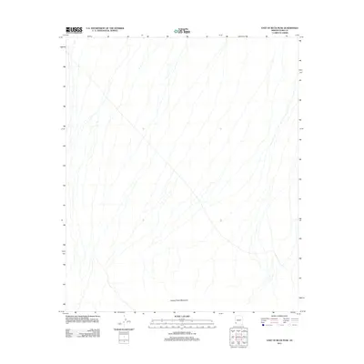
2011 Map of East of Buck Peak
USGS Topo · Published 2011About this map
Cabeza Prieta Mountains dominate the southern portion of this region in Yuma County, Arizona. This high-desert landscape is defined by an intricate network of drainage washes that flow generally northward across the alluvial plains. The detailed topography illustrates the complex hydrology of the Sonoran Desert, showing the natural channels that carry seasonal runoff from the mountain slopes. As a 2011 survey, this document records the undeveloped state of this land, primarily managed for conservation and military purposes. The lack of settlements or roads in this specific quadrangle highlights the preservation of a remote desert environment, where the terrain itself remains the primary feature of interest.
Find a feature on this map
1 named feature on this map. Tap any name to fly to it.
Don’t see what you’re looking for? This feature index may not catch every label — zoom into the map to look around manually.
Map Details
Editions of this 2011 East of Buck Peak Map
This is the sole edition of this map. No revisions or reprints were ever made.
Other maps of this area
1926 · Mohawk
USGS Topo · 1:62,500
1927 · Kim
USGS Topo · 1:62,500
1928 · Mohawk
USGS Topo · 1:62,500
1931 · Kim
USGS Topo · 1:62,500

1953 · Ajo
USGS Topo · 1:250,000

1957 · Ajo
USGS Topo · 1:250,000

1958 · Ajo
USGS Topo · 1:250,000

1962 · Ajo
USGS Topo · 1:250,000

1963 · Ajo
USGS Topo · 1:250,000
1965 · Cabeza Prieta Peak
USGS Topo · 1:62,500