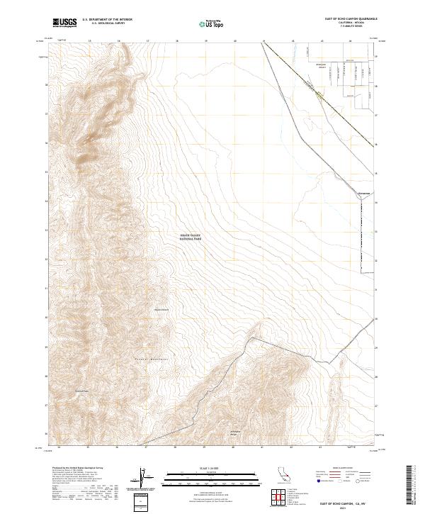
2021 Map of East of Echo Canyon
USGS Topo · Published 2021About this map
Death Valley National Park and the high desert of the Amargosa Desert dominate this landscape, where the California-Nevada state line cuts through the arid basins of Inyo and Nye counties. High peaks like Pyramid Peak and the rugged Funeral Mountains create dramatic relief against the low-lying Mojave Desert. The map reveals the stark topography of the Amargosa Range, showing how drainage patterns like Fortymile Wash define the basin floor. This modern survey illustrates the proximity of the small settlement of Scranton to the sprawling federal land boundaries, providing an exact record of the local road network, including Mecca Rd, S Miner St, and Cottonwood Rd, which navigate the desert floor east of the park boundaries.
Find a feature on this map
25 named features on this map. Tap any name to fly to it.
Don’t see what you’re looking for? This feature index may not catch every label — zoom into the map to look around manually.
Map Details
Editions of this 2021 East of Echo Canyon Map
This is the sole edition of this map. No revisions or reprints were ever made.
Other maps of this area

1908 · Furnace Creek
USGS Topo · 1:250,000

1910 · Furnace Creek
USGS Topo · 1:250,000

1942 · Skull Mountain
USGS Topo · 1:125,000

1942 · Bullfrog
USGS Topo · 1:125,000

1948 · Death Valley
USGS Topo · 1:250,000

1952 · Ash Meadows
USGS Topo · 1:62,500

1952 · Ryan
USGS Topo · 1:62,500

1952 · Big Dune
USGS Topo · 1:62,500

1954 · Death Valley
USGS Topo · 1:250,000

1956 · Death Valley
USGS Topo · 1:250,000