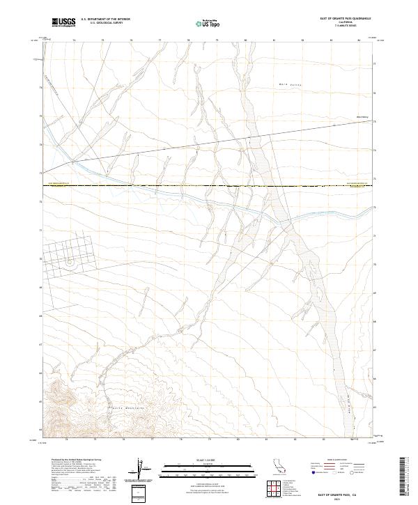
2021 Map of East of Granite Pass
USGS Topo · Published 2021About this map
Colorado River Aqueduct infrastructure defines this arid desert corridor, cutting across the landscape as it transports water toward the coast. The terrain is divided by the border of San Bernardino and Riverside Counties, which runs horizontally through the center of the sheet. To the south, the Granite Mountains rise sharply from the basin floor, providing a stark topographical contrast to the broad expanse of Ward Valley in the north. This modern survey illustrates the persistent importance of water management in the California desert, showing the aqueduct alongside drainage features like Sand Draw and the isolated utility route of Iron Mountain Pump Plant Rd.
Find a feature on this map
11 named features on this map. Tap any name to fly to it.
Don’t see what you’re looking for? This feature index may not catch every label — zoom into the map to look around manually.
Map Details
Editions of this 2021 East of Granite Pass Map
This is the sole edition of this map. No revisions or reprints were ever made.
Other maps of this area

1942 · Blythe
USGS Topo · 1:250,000

1942 · Amboy
USGS Topo · 1:250,000

1943 · Amboy
USGS Topo · 1:250,000

1943 · Iron Mountains
USGS Topo · 1:62,500

1945 · Midland
USGS Topo · 1:62,500

1952 · Midland
USGS Topo · 1:62,500

1952 · Palen Mountains
USGS Topo · 1:62,500

1954 · Salton Sea
USGS Topo · 1:250,000

1954 · Needles
USGS Topo · 1:250,000

1954 · Rice
USGS Topo · 1:62,500