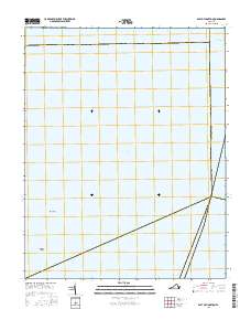
2016 Map of East of Hampton
USGS Topo · Published 2016About this map
Chesapeake Bay dominates this coastal survey, which documents the open water and maritime navigation routes off the Virginia coast in the early twenty-first century. This specific quadrangle captures a key segment of the Intracoastal Waterway as it passes near the border of Northampton Co. The bathymetry and seafloor terrain are highlighted by features such as Thimble Shoal and the area known as Horseshoe. This map is primarily an aquatic record, illustrating the vast expanse of the bay and the essential shipping and transit corridors that define the regional maritime economy east of the main Hampton shoreline.
Find a feature on this map
5 named features on this map. Tap any name to fly to it.
Don’t see what you’re looking for? This feature index may not catch every label — zoom into the map to look around manually.
Map Details
Editions of this 2016 East of Hampton Map
This is the sole edition of this map. No revisions or reprints were ever made.
Other maps of this area

1907 · Norfolk
USGS Topo · 1:125,000

1907 · Hampton
USGS Topo · 1:62,500

1918 · Cape Henry
USGS Topo · 1:62,500

1919 · Cape Henry
USGS Topo · 1:62,500

1921 · Newport News
USGS Topo · 1:62,500

1943 · Elliots Creek
USGS Topo · 1:25,000

1943 · Richmond
USGS Topo · 1:250,000

1944 · Hampton
USGS Topo · 1:24,000

1944 · Messick
USGS Topo · 1:24,000

1948 · Ocean View
USGS Topo · 1:24,000