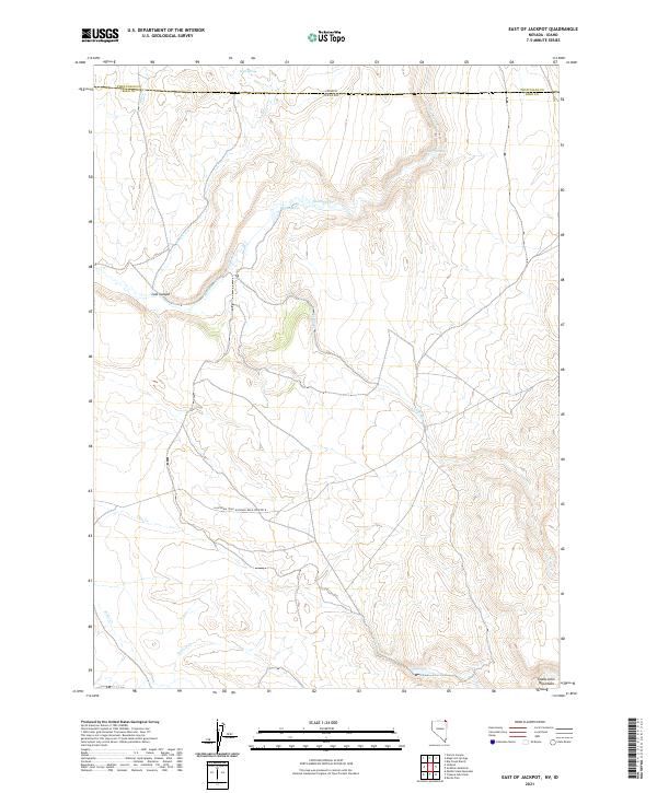
2021 Map of East of Jackpot
USGS Topo · Published 2021About this map
California Trail National Back Country Byway traverses the southern half of this landscape, marking a modern path over a deeply significant historical route for westward migration. The terrain is defined by the high elevations of the Toana John Mountains in the southeast, where seasonal drainages like Cedar Cr originate. The northern portion of the map is intersected by the Nevada-Idaho state line, dividing the high desert plateau where Shoshone Cr flows past Warm Springs. This area is heavily influenced by its water sources, with numerous springs such as Hole Spring and Deer Springs providing critical points of survival in an arid environment. The presence of Lost Canyon and several creeks, including Cow Cr and Willow Cr, illustrates the drainage patterns through the Elko County highlands just east of the Jackpot area.
Find a feature on this map
20 named features on this map. Tap any name to fly to it.
Don’t see what you’re looking for? This feature index may not catch every label — zoom into the map to look around manually.
Map Details
Editions of this 2021 East of Jackpot Map
This is the sole edition of this map. No revisions or reprints were ever made.
Other maps of this area

1955 · Twin Falls
USGS Topo · 1:250,000

1955 · Wells
USGS Topo · 1:250,000

1957 · Delaplain
USGS Topo · 1:62,500

1958 · Wells
USGS Topo · 1:250,000

1958 · Twin Falls
USGS Topo · 1:250,000

1961 · Wells
USGS Topo · 1:250,000

1961 · Gollaher Mountain
USGS Topo · 1:62,500

1977 · Big Creek Ranch
USGS Topo · 1:24,000

1977 · Magic Hot Springs
USGS Topo · 1:24,000
1978 · Meteor
USGS Topo · 1:24,000