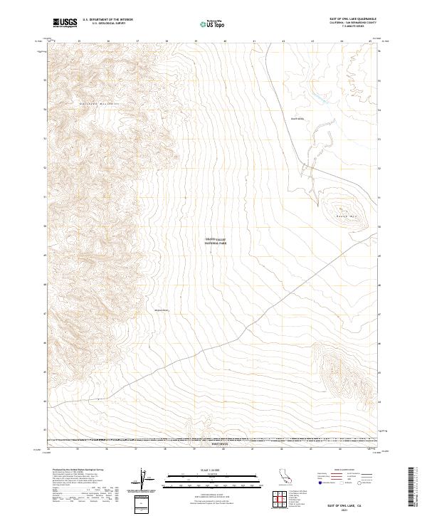
2021 Map of East of Owl Lake
USGS Topo · Published 2021About this map
Death Valley National Park and the northern reaches of Fort Irwin meet in this arid expanse of the Mojave Desert. The landscape is dominated by the steep, dissected topography of the Owlshead Mountains, which give way to the low alluvial basins of southern Death Valley. The ephemeral Amargosa River traces a path through the northeastern corner of the map, a critical drainage feature in an environment where water and terrain define all movement. This modern topographic study shows the stark contrast between the high peaks and the low valley floor near Round Mtn, reflecting the complex tectonic and erosional forces that have shaped this portion of San Bernardino County. The lack of permanent settlements underscores the area's history as a protected wilderness and military training ground.
Find a feature on this map
12 named features on this map. Tap any name to fly to it.
Don’t see what you’re looking for? This feature index may not catch every label — zoom into the map to look around manually.
Map Details
Editions of this 2021 East of Owl Lake Map
This is the sole edition of this map. No revisions or reprints were ever made.
Other maps of this area

1933 · Avawatz Mountains
USGS Topo · 1:250,000

1947 · Trona
USGS Topo · 1:250,000

1948 · Trona
USGS Topo · 1:250,000

1948 · Leach Lake
USGS Topo · 1:62,500

1948 · Avawatz Pass
USGS Topo · 1:62,500

1950 · Confidence Hills
USGS Topo · 1:62,500

1951 · Avawatz Pass
USGS Topo · 1:62,500
1951 · Leach Lake
USGS Topo · 1:62,500

1951 · Shoshone
USGS Topo · 1:62,500

1953 · Trona
USGS Topo · 1:250,000