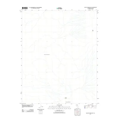
2012 Map of East of Sand Flat
USGS Topo · Published 2012About this map
Cottonwood Mountains terrain dominates this high-elevation desert landscape in Inyo County, characterized by a complex network of arid drainage systems and canyons. The topographical detail highlights the remote nature of this region, where seasonal water flow has carved significant features such as Marble Canyon and Cottonwood Canyon at the southern edge of the survey. To the northeast, the presence of the Niter Beds points to the specialized mineral deposits common to this part of California, offering a look at the natural resources that defined the area's geological history. The map's sparse labels reflect a wilderness largely untouched by development, focusing instead on the dramatic relief and natural watercourses that define the eastern reaches of the range.
Find a feature on this map
4 named features on this map. Tap any name to fly to it.
Don’t see what you’re looking for? This feature index may not catch every label — zoom into the map to look around manually.
Map Details
Editions of this 2012 East of Sand Flat Map
This is the sole edition of this map. No revisions or reprints were ever made.
Other maps of this area

1908 · Ballarat
USGS Topo · 1:250,000

1913 · Ballarat
USGS Topo · 1:250,000

1948 · Death Valley
USGS Topo · 1:250,000
1951 · Marble Canyon
USGS Topo · 1:62,500
1952 · Stovepipe Wells
USGS Topo · 1:62,500

1954 · Death Valley
USGS Topo · 1:250,000

1956 · Death Valley
USGS Topo · 1:250,000
1957 · Death Valley
USGS Topo · 1:250,000
1957 · Grapevine Peak
USGS Topo · 1:62,500
1957 · Tin Mountain
USGS Topo · 1:62,500