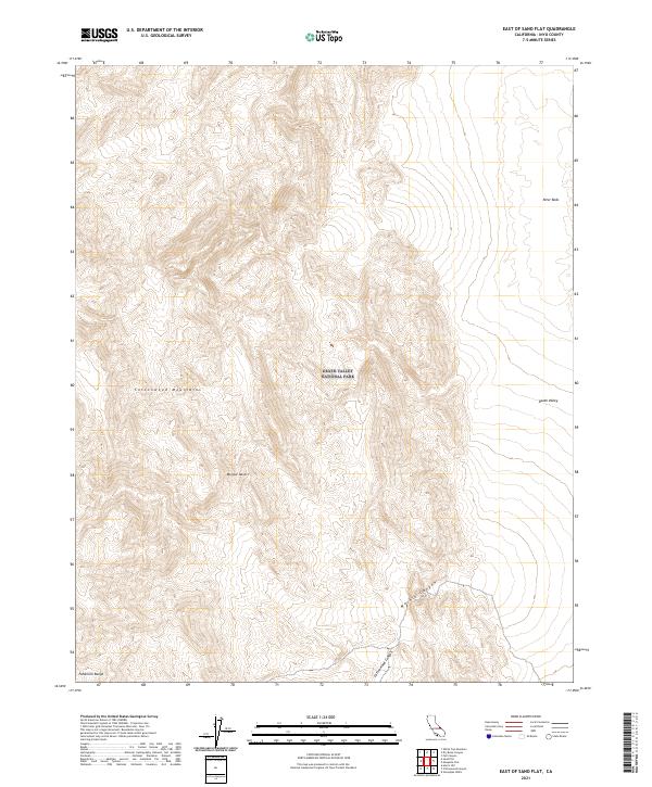
2021 Map of East of Sand Flat
USGS Topo · Published 2021About this map
Death Valley National Park encompasses this high-altitude desert terrain, where the steep ridgelines of the Cottonwood Mountains and the Panamint Range converge. The topography is defined by dramatic elevation changes, notably where Cottonwood Canyon and Marble Canyon cut through the arid slopes. A significant geological point of interest is the Niter Beds in the northeastern quadrant, suggesting historical mineral deposits in this part of the Mojave Desert. The map documents the vast, unpopulated reaches of Death Valley just before the terrain descends into the lower basin, providing a detailed record of the landforms and survey boundaries like t14s r43e that define this protected wilderness.
Find a feature on this map
12 named features on this map. Tap any name to fly to it.
Don’t see what you’re looking for? This feature index may not catch every label — zoom into the map to look around manually.
Map Details
Editions of this 2021 East of Sand Flat Map
This is the sole edition of this map. No revisions or reprints were ever made.
Other maps of this area

1908 · Ballarat
USGS Topo · 1:250,000

1913 · Ballarat
USGS Topo · 1:250,000

1948 · Death Valley
USGS Topo · 1:250,000

1951 · Marble Canyon
USGS Topo · 1:62,500

1952 · Stovepipe Wells
USGS Topo · 1:62,500

1954 · Death Valley
USGS Topo · 1:250,000

1956 · Death Valley
USGS Topo · 1:250,000

1957 · Death Valley
USGS Topo · 1:250,000
1957 · Grapevine Peak
USGS Topo · 1:62,500

1957 · Tin Mountain
USGS Topo · 1:62,500