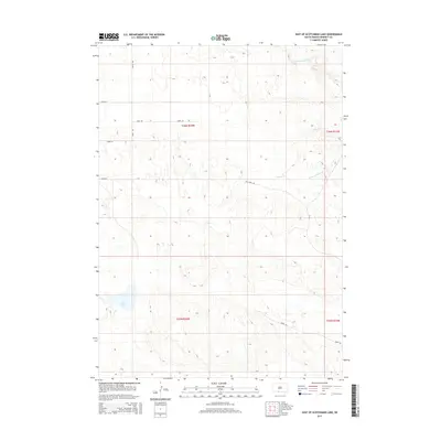
2015 Map of East of Scotchman Lake
USGS Topo · Published 2015About this map
Little White River flows across the northern reach of this Bennett County landscape, carving a distinct valley through the high plains of South Dakota. The drainage network is further defined by Cedar Cr and the S Fork of Cedar Cr, which traverse the central and eastern sections. In the southwest, the presence of Clear Lake provides a significant hydrological marker in an otherwise arid expanse. The map illustrates a strictly organized section-line road system characteristic of the rural Great Plains, featuring routes like Hawk Rd, Kill Deer Rd, and Crane Rd. This grid reflects the enduring Public Land Survey System, with township boundaries for t36n r34w and t35n r34w clearly delineated. The terrain is marked by subtle topographic rises and depressions, showing the transition between the river lowlands and the higher prairie flats.
Find a feature on this map
16 named features on this map. Tap any name to fly to it.
Don’t see what you’re looking for? This feature index may not catch every label — zoom into the map to look around manually.
Map Details
Editions of this 2015 East of Scotchman Lake Map
This is the sole edition of this map. No revisions or reprints were ever made.
Other maps of this area
1950 · Cody
USGS Topo · 1:62,500
1952 · Eli
USGS Topo · 1:62,500

1955 · Martin
USGS Topo · 1:250,000

1957 · Valentine
USGS Topo · 1:250,000

1958 · Martin
USGS Topo · 1:250,000

1959 · Valentine
USGS Topo · 1:250,000
1969 · Spring Creek SW
USGS Topo · 1:24,000
1969 · Iron Shell Flat West
USGS Topo · 1:24,000
1981 · Scotchman Lake
USGS Topo · 1:25,000
1981 · Tuthill
USGS Topo · 1:25,000