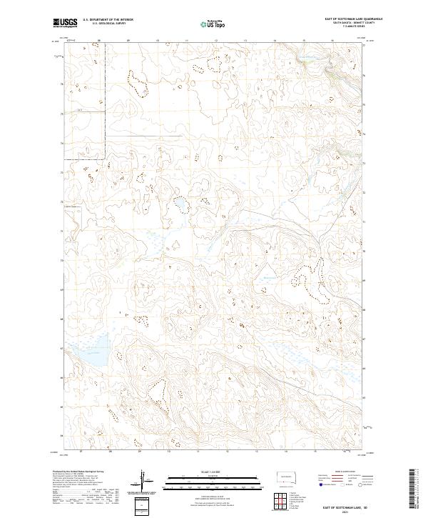
2021 Map of East of Scotchman Lake
USGS Topo · Published 2021About this map
The Little White River winds through the northern portion of this Bennett County landscape, defining a terrain shaped by water and elevation. In the central and southern reaches, Muskrat Lake and Clear Lake stand as prominent features of the prairie hydrologic system. This 2021 survey illustrates the rural grid of southwestern South Dakota, where 298 St serves as one of the few named corridors across the townships. The drainage network is further detailed by the Cedar Cr and the S Fork of Cedar Cr, which provide a clear view of the local watershed and topographical relief before it reaches the river valley.
Find a feature on this map
10 named features on this map. Tap any name to fly to it.
Don’t see what you’re looking for? This feature index may not catch every label — zoom into the map to look around manually.
Map Details
Editions of this 2021 East of Scotchman Lake Map
This is the sole edition of this map. No revisions or reprints were ever made.
Other maps of this area

1950 · Cody
USGS Topo · 1:62,500

1952 · Eli
USGS Topo · 1:62,500

1955 · Martin
USGS Topo · 1:250,000

1957 · Valentine
USGS Topo · 1:250,000

1958 · Martin
USGS Topo · 1:250,000

1959 · Valentine
USGS Topo · 1:250,000

1969 · Spring Creek SW
USGS Topo · 1:24,000

1969 · Iron Shell Flat West
USGS Topo · 1:24,000

1981 · Scotchman Lake
USGS Topo · 1:25,000

1981 · Tuthill
USGS Topo · 1:25,000