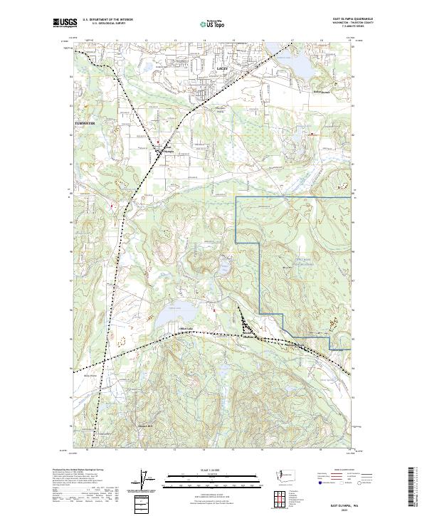
2023 Map of East Olympia
USGS Topo · Published 2023About this map
Lacey and the surrounding prairies of Thurston County are captured in this recent survey, showcasing the modern layout of south Puget Sound settlements. The landscape is defined by the winding course of the Deschutes River and the broad open spaces of Chambers Prairie and Rocky Prairie. While the northern portion of the map is densely gridded with residential developments near Tumwater, the eastern edge transitions into the military grounds of Joint Base Lewis-McChord.
Find a feature on this map
130 named features on this map. Tap any name to fly to it.
Don’t see what you’re looking for? This feature index may not catch every label — zoom into the map to look around manually.
Map Details
Editions of this 2023 East Olympia Map
This is the sole edition of this map. No revisions or reprints were ever made.
Other maps of this area

1916 · Chehalis
USGS Topo · 1:125,000

1937 · Olympia
USGS Topo · 1:62,500

1940 · Tenino
USGS Topo · 1:62,500

1940 · Anderson Island
USGS Topo · 1:62,500

1944 · Tenino
USGS Topo · 1:62,500

1944 · Yelm
USGS Topo · 1:62,500

1948 · Anderson Island
USGS Topo · 1:62,500

1948 · Nisqually
USGS Topo · 1:24,000

1949 · Yelm
USGS Topo · 1:62,500

1949 · Tenino
USGS Topo · 1:62,500