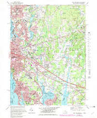
2024 Map of East Providence
USGS Topo · Published 2024About this map
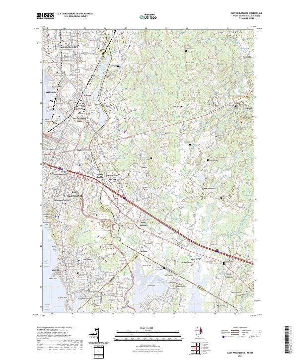
The Runnins River and Ten Mile River form a complex hydrologic border between Rhode Island and Massachusetts, shaping a landscape of suburban density and protected wetland corridors. In the western portion, the city of East Providence transitions from industrial reaches like Sabin Point Reach to historic village centers such as Rumford. This 2024 survey documents a remarkably high density of small family burial lots and historic cemeteries, including the Ancient Little Neck Burial Ground and Newman Cem, which offer significant value for genealogical research in one of the oldest settled regions of New England. Moving eastward, the terrain opens into the woodlands of Seekonk and Rehoboth, where features like Jacobs Hill and the Palmer River basin remain central to the local geography. Significant landmarks such as Hundred Acre Cove and Nockum Hill illustrate the preservation of coastal marshes amidst the surrounding growth.
Find a feature on this map
100 named features on this map. Tap any name to fly to it.
Don’t see what you’re looking for? This feature index may not catch every label — zoom into the map to look around manually.
Map Details
Editions of this 2024 East Providence Map
This is the sole edition of this map. No revisions or reprints were ever made.
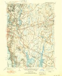
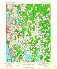
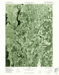
Historical Maps of Monroes Through Time
5 maps found