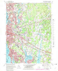
1971 Map of East Providence
USGS Topo · Published 1979About this map
East Providence and the surrounding borderlands of Rhode Island and Massachusetts show a dense network of suburban development and coastal industry during the late 1970s. The landscape is defined by the Seekonk River and Providence River, where maritime infrastructure like Bucklin Point meets residential clusters such as Rumford and Riverside. Significant educational and recreational spaces are scattered throughout, including Barrington College, McCoy Stadium, and Slater Memorial Park.
Find a feature on this map
110 named features on this map. Tap any name to fly to it.
Don’t see what you’re looking for? This feature index may not catch every label — zoom into the map to look around manually.
Map Details
Editions of this 1971 East Providence Map
4 editions found
Other maps of this area

1885 · Taunton
USGS Topo · 1:62,500

1887 · Providence
USGS Topo · 1:62,500

1888 · Fall River
USGS Topo · 1:62,500

1888 · Taunton
USGS Topo · 1:62,500

1889 · Providence
USGS Topo · 1:62,500

1890 · Narragansett Bay
USGS Topo · 1:62,500

1892 · Narragansett Bay
USGS Topo · 1:62,500

1893 · Taunton
USGS Topo · 1:62,500

1893 · Fall River
USGS Topo · 1:62,500

1894 · Providence
USGS Topo · 1:62,500