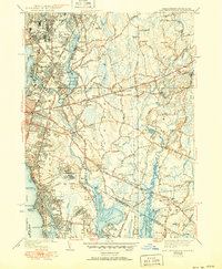
1941 Map of East Providence
USGS Topo · Published 1951About this map
Phillipsdale and Rumford anchor the northern industrial landscape of the East Providence area in the decade following the 1930s surveys. The urban core shows a dense network of neighborhoods including Kents Heights and Riverside, transitioning into the marshy reaches of Hundred Acre Cove and the Warren River. Notable recreational landmarks like Crescent Park and the Narragansett Race Track highlight the era's social hubs, while the Providence and Bristol RR line provides the essential transportation corridor for the region's suburban growth. The map reveals a high density of community infrastructure, from the McCoy Stadium to local institutions such as the Newman Ave Sch and Mt Carmel Ch. Genealogists will find significant value in the clearly marked burial grounds, including the historic Little Neck Cemetery and Mt St Marys Cemetery.
Find a feature on this map
99 named features on this map. Tap any name to fly to it.
Don’t see what you’re looking for? This feature index may not catch every label — zoom into the map to look around manually.
Map Details
Editions of this 1941 East Providence Map
3 editions found
Other maps of this area

1885 · Taunton
USGS Topo · 1:62,500

1887 · Providence
USGS Topo · 1:62,500

1888 · Fall River
USGS Topo · 1:62,500

1888 · Taunton
USGS Topo · 1:62,500

1889 · Providence
USGS Topo · 1:62,500

1890 · Narragansett Bay
USGS Topo · 1:62,500

1892 · Narragansett Bay
USGS Topo · 1:62,500

1893 · Taunton
USGS Topo · 1:62,500

1893 · Fall River
USGS Topo · 1:62,500

1894 · Providence
USGS Topo · 1:62,500