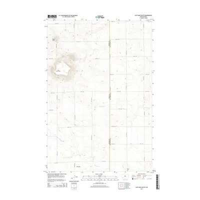
2014 Map of East Rainy Butte
USGS Topo · Published 2014About this map
East Rainy Butte dominates the local topography of this Slope County landscape, rising sharply above the surrounding prairie as a prominent landmark. This 2014 survey documents the sparsely populated region where the border between Slope and Hettinger counties is defined by the section line along 120th Ave SW. The small settlement of De Sart sits in the southwestern portion of the map, serving as a focal point for the rural road network that follows a rigid grid system.
Find a feature on this map
23 named features on this map. Tap any name to fly to it.
Don’t see what you’re looking for? This feature index may not catch every label — zoom into the map to look around manually.
Map Details
Editions of this 2014 East Rainy Butte Map
This is the sole edition of this map. No revisions or reprints were ever made.
Other maps of this area

1953 · Dickinson
USGS Topo · 1:250,000

1957 · Dickinson
USGS Topo · 1:250,000

1961 · Daglum
USGS Topo · 1:62,500

1973 · Warnke Hill
USGS Topo · 1:24,000

1973 · Cedar Lake
USGS Topo · 1:24,000

1973 · Jung Lake
USGS Topo · 1:24,000

1973 · New England
USGS Topo · 1:24,000

1973 · West Rainy Butte
USGS Topo · 1:24,000

1973 · East Rainy Butte
USGS Topo · 1:24,000

1973 · Enterprise School
USGS Topo · 1:24,000