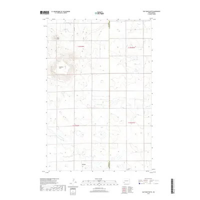
2018 Map of East Rainy Butte
USGS Topo · Published 2018About this map
De Sart and the surrounding high plains of Slope Co and Hettinger Co are defined by the prominent heights of Baldy Butte and East Rainy Butte. This portion of southwestern North Dakota is characterized by a high plateau landscape where the drainage patterns of Coal Bank Cr and Chanta Peta Cr have carved intricate coulees into the prairie. The map shows the thin network of section-line roads and scattered agricultural homesteads typical of this region's modern ranching and farming economy. Notable landmarks for local history include the Johnson Cem near the southern boundary, providing a point of interest for genealogists researching families from this corner of the state. The contrast between the flat upland plains and the sudden elevation of the buttes illustrates the unique geological formations of the Badlands fringe.
Find a feature on this map
3 named features on this map. Tap any name to fly to it.
Don’t see what you’re looking for? This feature index may not catch every label — zoom into the map to look around manually.
Map Details
Editions of this 2018 East Rainy Butte Map
This is the sole edition of this map. No revisions or reprints were ever made.
Other maps of this area

1953 · Dickinson
USGS Topo · 1:250,000

1957 · Dickinson
USGS Topo · 1:250,000

1961 · Daglum
USGS Topo · 1:62,500

1973 · Warnke Hill
USGS Topo · 1:24,000

1973 · Cedar Lake
USGS Topo · 1:24,000

1973 · Jung Lake
USGS Topo · 1:24,000

1973 · New England
USGS Topo · 1:24,000

1973 · West Rainy Butte
USGS Topo · 1:24,000

1973 · East Rainy Butte
USGS Topo · 1:24,000

1973 · Enterprise School
USGS Topo · 1:24,000