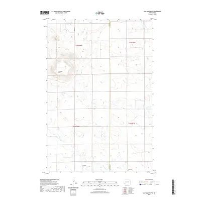
2020 Map of East Rainy Butte
USGS Topo · Published 2020About this map
East Rainy Butte and Baldy Butte dominate the northern landscape of this prairie terrain, where the High Plains drop into a network of seasonal drainage creeks. The small settlement of De Sart sits at a remote crossroads in the southwestern portion of the map, serving as a focal point for the surrounding agricultural sections. The local geography is defined by its watercourses, including the winding Coal Bank Cr, Chanta Peta Cr, and Goose Cr, which carve subtle relief into the plains. The presence of Johnson Cem in the southeastern corner near the Slope Co Hettinger Co line provides a specific point of interest for genealogists tracing early families in this rural borderland. The township and range lines reveal the orderly grid of Western settlement, with section roads like 125th Ave SW and 61st St SW connecting the isolated ranch and farm sites.
Find a feature on this map
17 named features on this map. Tap any name to fly to it.
Don’t see what you’re looking for? This feature index may not catch every label — zoom into the map to look around manually.
Map Details
Editions of this 2020 East Rainy Butte Map
This is the sole edition of this map. No revisions or reprints were ever made.
Other maps of this area

1953 · Dickinson
USGS Topo · 1:250,000

1957 · Dickinson
USGS Topo · 1:250,000

1961 · Daglum
USGS Topo · 1:62,500

1973 · Warnke Hill
USGS Topo · 1:24,000

1973 · Cedar Lake
USGS Topo · 1:24,000

1973 · Jung Lake
USGS Topo · 1:24,000

1973 · New England
USGS Topo · 1:24,000

1973 · West Rainy Butte
USGS Topo · 1:24,000

1973 · East Rainy Butte
USGS Topo · 1:24,000

1973 · Enterprise School
USGS Topo · 1:24,000