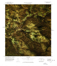
1977 Map of East Richford Station
USGS Topo · Published 1978About this map
The Missisquoi River valley carves a vital corridor through the Vermont-Quebec borderlands in this late 1970s orthophoto survey. This unique collaboration between the USGS and the U.S. Customs Service highlights the geography of international transit. The Canadian Pacific railroad parallels the river, passing through border outposts like East Richford and Stevens Mills. The aerial imagery reveals the sharp contrast between the wooded slopes of Sutton Mountain and the cleared agricultural plots near Glen Sutton and Glenton.
Find a feature on this map
17 named features on this map. Tap any name to fly to it.
Don’t see what you’re looking for? This feature index may not catch every label — zoom into the map to look around manually.
Map Details
Editions of this 1977 East Richford Station Map
This is the sole edition of this map. No revisions or reprints were ever made.
Other maps of this area

1919 · Montgomery
USGS Topo · 1:62,500

1920 · Montgomery
USGS Topo · 1:62,500

1920 · Irasburg
USGS Topo · 1:62,500

1923 · Irasburg
USGS Topo · 1:48,000

1925 · Irasburg
USGS Topo · 1:62,500

1925 · Jay Peak
USGS Topo · 1:62,500

1943 · Jay Peak
USGS Topo · 1:62,500

1950 · Lake Champlain
USGS Topo · 1:250,000

1953 · Jay Peak
USGS Topo · 1:62,500

1953 · Irasburg
USGS Topo · 1:62,500