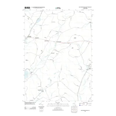
2013 Map of East Springfield
USGS Topo · Published 2013About this map
Otsego Lake and the northern reaches of Glimmerglass State Park anchor the southwestern corner of this landscape, where the historic Hyde Hall Covered Bridge spans the water. Moving eastward, the terrain transitions from the heights of Mount Wellington and Pine Cobble into the agricultural valleys of Middle Village and East Springfield. This region is defined by its deep genealogical roots, visible in the numerous burial grounds like Old Middlefield Center Cem and Mid Village Cem that dot the countryside. The map traces the winding course of Shadow Brook and Cherry Valley Cr through a network of rural routes such as Salt Springville Rd and Summit Hill Rd. Aviation and recreation also leave their mark with the De Ronda Airport situated near the northern boundary and the Cooperstown Shadow Brook Campground providing a modern link to the area's long-standing status as a destination for travelers.
Find a feature on this map
94 named features on this map. Tap any name to fly to it.
Don’t see what you’re looking for? This feature index may not catch every label — zoom into the map to look around manually.
Map Details
Editions of this 2013 East Springfield Map
This is the sole edition of this map. No revisions or reprints were ever made.
Other maps of this area

1898 · Canajoharie
USGS Topo · 1:62,500

1900 · Canajoharie
USGS Topo · 1:62,500

1902 · Canajoharie
USGS Topo · 1:62,500

1903 · Richfield Springs
USGS Topo · 1:62,500

1904 · Richmondville
USGS Topo · 1:62,500

1907 · Cooperstown
USGS Topo · 1:62,500

1909 · Cooperstown
USGS Topo · 1:62,500

1943 · Jordanville
USGS Topo · 1:24,000

1943 · South Valley
USGS Topo · 1:24,000

1943 · Richfield Springs
USGS Topo · 1:24,000