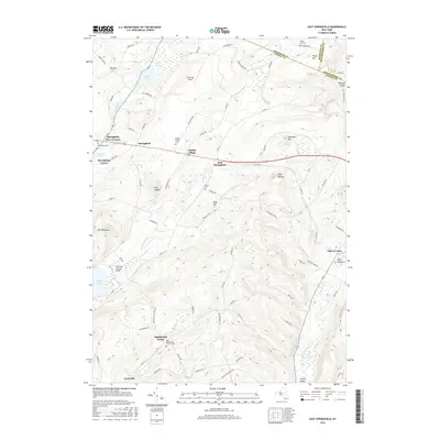
2016 Map of East Springfield
USGS Topo · Published 2016About this map
The Hyde Hall Covered Bridge stands near the northern tip of Otsego Lake, anchoring a landscape where the headwaters of Cherry Valley Cr and Shadow Brook carve through high terrain. This area of Upstate New York is defined by a network of historic hamlets, including Springfield Four Corners, Middle Village, and East Springfield, which follow the traditional corridors of the Mohawk Valley foothills. Genealogists will find a high density of burial grounds like the Springfield Cem and the Old Middlefield Center Cem, reflecting over two centuries of settlement. High peaks such as Shankley Mtn and Mt Wellington rise above the agricultural valleys, while landmarks like the De Ronda Airport and the narrow Dugway Gorge illustrate the intersection of modern transport and complex topography at the borders of Herkimer, Otsego, and Montgomery Counties.
Find a feature on this map
87 named features on this map. Tap any name to fly to it.
Don’t see what you’re looking for? This feature index may not catch every label — zoom into the map to look around manually.
Map Details
Editions of this 2016 East Springfield Map
This is the sole edition of this map. No revisions or reprints were ever made.
Other maps of this area

1898 · Canajoharie
USGS Topo · 1:62,500

1900 · Canajoharie
USGS Topo · 1:62,500

1902 · Canajoharie
USGS Topo · 1:62,500

1903 · Richfield Springs
USGS Topo · 1:62,500

1904 · Richmondville
USGS Topo · 1:62,500

1907 · Cooperstown
USGS Topo · 1:62,500

1909 · Cooperstown
USGS Topo · 1:62,500

1943 · Jordanville
USGS Topo · 1:24,000

1943 · South Valley
USGS Topo · 1:24,000

1943 · Richfield Springs
USGS Topo · 1:24,000