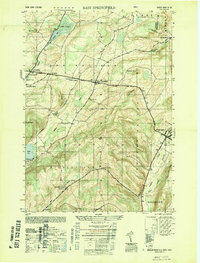
1949 Map of East Springfield
USGS Topo · Published 1949About this map
Springfield Cem and Springfield Ch anchor the early settlements of this corner of Otsego County during the late 1940s. The landscape is defined by the historic Cherry Valley Turnpike, which serves as a major east-west artery connecting Springfield Middle Village, East Springfield, and Cherry Valley. The map reveals a post-war rural infrastructure still heavily reliant on local landmarks, including several schools like the Continental School and the Middlefield Center School No 9.
Find a feature on this map
41 named features on this map. Tap any name to fly to it.
Don’t see what you’re looking for? This feature index may not catch every label — zoom into the map to look around manually.
Map Details
Editions of this 1949 East Springfield Map
This is the sole edition of this map. No revisions or reprints were ever made.
Other maps of this area

1898 · Canajoharie
USGS Topo · 1:62,500

1900 · Canajoharie
USGS Topo · 1:62,500

1902 · Canajoharie
USGS Topo · 1:62,500

1903 · Richfield Springs
USGS Topo · 1:62,500

1904 · Richmondville
USGS Topo · 1:62,500

1907 · Cooperstown
USGS Topo · 1:62,500

1909 · Cooperstown
USGS Topo · 1:62,500

1943 · Jordanville
USGS Topo · 1:24,000

1943 · South Valley
USGS Topo · 1:24,000

1943 · Richfield Springs
USGS Topo · 1:24,000