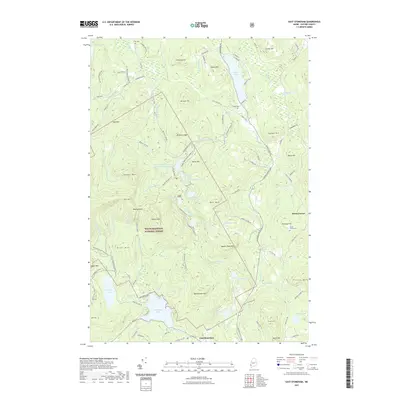
2021 Map of East Stoneham
USGS Topo · Published 2021About this map
White Mountain National Forest dominates the western portion of this Maine landscape, where the peaks of Albany Mtn and Pine Mtn overlook deep valleys and secluded water bodies. The settlement of East Stoneham lies at the southern edge near Keewaydin Lake, while Hunts Corner marks a secondary cluster to the east. The terrain is characterized by numerous glacial features and granite heights such as Rattlesnake Mtn and Square Dock Mtn, interspersed with smaller ponds like Mosquito Pond and Broken Bridge Pond.
Find a feature on this map
118 named features on this map. Tap any name to fly to it.
Don’t see what you’re looking for? This feature index may not catch every label — zoom into the map to look around manually.
Map Details
Editions of this 2021 East Stoneham Map
This is the sole edition of this map. No revisions or reprints were ever made.
Other maps of this area

1896 · Norway
USGS Topo · 1:62,500

1909 · Fryeburg
USGS Topo · 1:62,500

1911 · Fryeburg
USGS Topo · 1:62,500

1911 · Bryant Pond
USGS Topo · 1:62,500

1914 · Bethel
USGS Topo · 1:62,500

1914 · Bryant Pond
USGS Topo · 1:62,500

1940 · Bethel
USGS Topo · 1:62,500

1941 · Bethel
USGS Topo · 1:62,500

1941 · Fryeburg
USGS Topo · 1:62,500

1942 · Bryant Pond
USGS Topo · 1:62,500