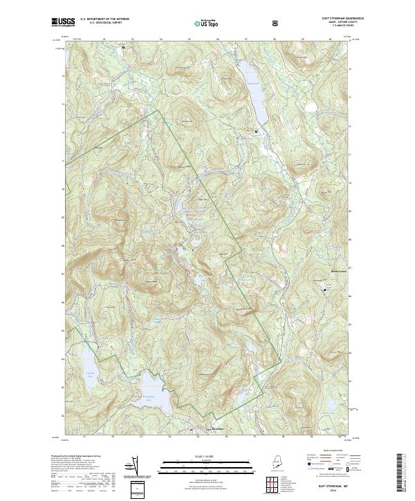
2024 Map of East Stoneham
USGS Topo · Published 2024About this map
White Mountain National Forest dominates the western interior of this Oxford County landscape, where the granite peaks of Albany Mtn and Farwell Mtn rise above the drainage of the West Branch Pleasant River. Settlement is concentrated along the southern and eastern corridors, particularly at East Stoneham and the crossroads of Hunts Corner. The area is characterized by a complex network of glacial ponds and water management features, including the Patte Brook Waterfowl Impoundment Reservoir and the tranquil Keewaydin Lake. Genealogists will find valuable reference points in the historic Flat Cem, Songo Cem, and the Hunts Corner Cem, while the location of the Bennett School provides a glimpse into the former rural educational infrastructure of the township.
Find a feature on this map
114 named features on this map. Tap any name to fly to it.
Don’t see what you’re looking for? This feature index may not catch every label — zoom into the map to look around manually.
Map Details
Editions of this 2024 East Stoneham Map
This is the sole edition of this map. No revisions or reprints were ever made.
Other maps of this area

1896 · Norway
USGS Topo · 1:62,500

1909 · Fryeburg
USGS Topo · 1:62,500

1911 · Fryeburg
USGS Topo · 1:62,500

1911 · Bryant Pond
USGS Topo · 1:62,500

1914 · Bethel
USGS Topo · 1:62,500

1914 · Bryant Pond
USGS Topo · 1:62,500

1940 · Bethel
USGS Topo · 1:62,500

1941 · Bethel
USGS Topo · 1:62,500

1941 · Fryeburg
USGS Topo · 1:62,500

1942 · Bryant Pond
USGS Topo · 1:62,500