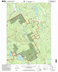
1995 Map of East Stoneham
USGS Topo · Published 2000About this map
White Mountain National Forest dominates this Oxford County landscape, where the transition from late 20th-century timberland to recreational wilderness is clearly mapped. The settlement of East Stoneham lies at the southern edge of the quadrangle, serving as a gateway to the high peaks and interior ponds. The topography is defined by significant elevations like Rattlesnake Mountain and Albany Mountain, which frame the Crooked River valley. This 1995 revision captures the intricate network of water bodies, including the large Keewaydin Lake and Songo Pond, alongside smaller, isolated features like Sunken Pond and Waterfowl Marsh. Genealogists will find value in the precise locations of the Flat Cemetery and Songo Cem, as well as named family landmarks such as Cummings Hill and Bacon Hill. The presence of the New England Trail and various forest roads underscores the region's enduring character as a hub for both industry and wilderness access.
Find a feature on this map
72 named features on this map. Tap any name to fly to it.
Don’t see what you’re looking for? This feature index may not catch every label — zoom into the map to look around manually.
Map Details
Editions of this 1995 East Stoneham Map
This is the sole edition of this map. No revisions or reprints were ever made.
Other maps of this area

1896 · Norway
USGS Topo · 1:62,500

1909 · Fryeburg
USGS Topo · 1:62,500

1911 · Fryeburg
USGS Topo · 1:62,500

1911 · Bryant Pond
USGS Topo · 1:62,500

1914 · Bethel
USGS Topo · 1:62,500

1914 · Bryant Pond
USGS Topo · 1:62,500

1940 · Bethel
USGS Topo · 1:62,500

1941 · Bethel
USGS Topo · 1:62,500

1941 · Fryeburg
USGS Topo · 1:62,500

1942 · Bryant Pond
USGS Topo · 1:62,500