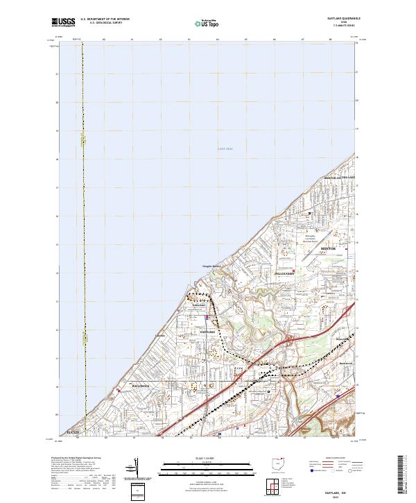
2023 Map of Eastlake
USGS Topo · Published 2023About this map
Lake Erie defines the northern extent of this suburban lakefront landscape, where the Chagrin River meanders through Willoughby and Eastlake before reaching Chagrin Harbor. The map reveals a dense network of residential development and community infrastructure, including the Andrews School and the Bryant and Stratton College - Eastlake Campus. Local history is preserved at the Lost Nation Road Cem and Willoughby Village Cem, while industrial and transit corridors are represented by the CSX railroad line and the Willoughby Lost Nation Municipal Airport. Small incorporated enclaves like Lakeline and Timberlake sit along the shore, illustrating the fragmented municipal growth of the Lake County coast. The interior is marked by neighborhood-scale features such as Ward Brook and the distinct elevation at Elk Point.
Find a feature on this map
209 named features on this map. Tap any name to fly to it.
Don’t see what you’re looking for? This feature index may not catch every label — zoom into the map to look around manually.
Map Details
Editions of this 2023 Eastlake Map
This is the sole edition of this map. No revisions or reprints were ever made.
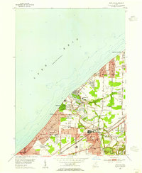
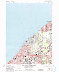
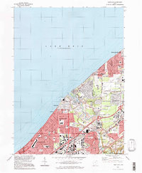
Historical Maps of Timberlake Through Time
4 maps found