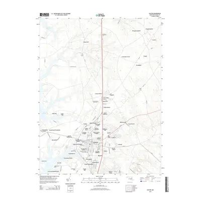
2014 Map of Easton
USGS Topo · Published 2014About this map
Easton serves as the primary hub of this Maryland Eastern Shore landscape, surrounded by an intricate network of residential additions and historically named tracts. The town’s heritage is visible in sites like the Third Haven Meeting Burial Ground and the All Saints Cem near Longwoods, reflecting centuries of local settlement. Modern growth is evident in the cluster of neighborhoods including Carrolls Addition, Calvert Terrace, and Dover Acres, which expand outward from the traditional center.
Find a feature on this map
112 named features on this map. Tap any name to fly to it.
Don’t see what you’re looking for? This feature index may not catch every label — zoom into the map to look around manually.
Map Details
Editions of this 2014 Easton Map
This is the sole edition of this map. No revisions or reprints were ever made.
Other maps of this area

1898 · Choptank
USGS Topo · 1:125,000

1904 · St. Michaels
USGS Topo · 1:62,500

1904 · Oxford
USGS Topo · 1:62,500

1905 · Denton
USGS Topo · 1:62,500

1905 · Hurlock
USGS Topo · 1:62,500

1908 · Choptank
USGS Topo · 1:125,000

1942 · Oxford
USGS Topo · 1:31,680
1942 · Queenstown
USGS Topo · 1:24,000
1942 · Easton
USGS Topo · 1:24,000
1942 · Wye Mills
USGS Topo · 1:24,000