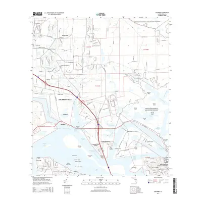
2015 Map of Eastport
USGS Topo · Published 2015About this map
Yellow Bluff Fort stands as a focal point of this coastal landscape north of Jacksonville, where the complex estuary of the Saint Johns River meets a network of marshes and islands. The map details the intricate waterways of the Timucuan Ecological and Historic Preserve, revealing the tidal nature of the region through features like Mill Cove, Clapboard Creek, and Brouard River. Residential and industrial patterns are visible in settlements such as Eastport and New Berlin, while the massive footprint of Blount Island and its surrounding channels indicates the significance of the maritime economy. To the south, the Fort Caroline National Memorial preserves local history near established neighborhoods like Beacon Hills. For genealogists, the map identifies specific local sites including Dunn Creek Cem and small communities like Polly Town and Quinlan that define the area's mid-century growth.
Find a feature on this map
216 named features on this map. Tap any name to fly to it.
Don’t see what you’re looking for? This feature index may not catch every label — zoom into the map to look around manually.
Map Details
Editions of this 2015 Eastport Map
This is the sole edition of this map. No revisions or reprints were ever made.
Other maps of this area

1918 · St Marys
USGS Topo · 1:62,500

1918 · Jacksonville
USGS Topo · 1:62,500

1918 · Mayport
USGS Topo · 1:62,500

1919 · Fernandina
USGS Topo · 1:62,500

1919 · St Marys
USGS Topo · 1:62,500

1944 · Fernandina
USGS Topo · 1:62,500

1948 · Jacksonville
USGS Topo · 1:250,000

1948 · Jacksonville Beach
USGS Topo · 1:24,000

1948 · Eastport
USGS Topo · 1:24,000

1949 · Jacksonville Beach
USGS Topo · 1:24,000
Featured Places
- Jacksonville, FL
- Dames Point Manor, Jacksonville
- Beacon Hills, Jacksonville
- Fort Caroline, Jacksonville
- New Berlin, Jacksonville