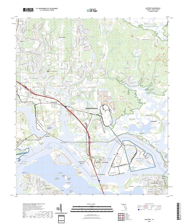
2024 Map of Eastport
USGS Topo · Published 2024About this map
Saint Johns River and its complex network of tributaries dominate this survey of the industrial and protected coastal landscapes north of Jacksonville. The map captures a unique intersection of heavy maritime commerce and conservation, where the massive Blount Island shipping terminals sit adjacent to the protected wetlands of the Timucuan Ecological and Historic Preserve. Traces of the region's long military history are visible at Yellow Bluff Fort and the Fort Caroline site near Beacon Hills. Smaller, distinct settlements like New Berlin, Eastport, and Polly Town are mapped alongside extensive swamp systems including Sample Swamp and Caney Swamp. For those researching local families, the Dunn Creek Cem and numerous named points like Dames Point and Drummond Point provide essential geographic context for the northeastern Florida coast.
Find a feature on this map
94 named features on this map. Tap any name to fly to it.
Don’t see what you’re looking for? This feature index may not catch every label — zoom into the map to look around manually.
Map Details
Editions of this 2024 Eastport Map
This is the sole edition of this map. No revisions or reprints were ever made.
Other maps of this area

1918 · St Marys
USGS Topo · 1:62,500

1918 · Jacksonville
USGS Topo · 1:62,500

1918 · Mayport
USGS Topo · 1:62,500

1919 · Fernandina
USGS Topo · 1:62,500

1919 · St Marys
USGS Topo · 1:62,500

1944 · Fernandina
USGS Topo · 1:62,500

1948 · Jacksonville
USGS Topo · 1:250,000

1948 · Jacksonville Beach
USGS Topo · 1:24,000

1948 · Eastport
USGS Topo · 1:24,000

1949 · Jacksonville Beach
USGS Topo · 1:24,000
Featured Places
- Jacksonville, FL
- Dames Point Manor, Jacksonville
- Eastport, Jacksonville
- Beacon Hills, Jacksonville
- Fort Caroline, Jacksonville