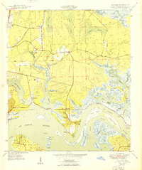
1950 Map of Eastport
USGS Topo · Published 1950About this map
New Berlin and Eastport anchor this coastal landscape along the St Johns River, where mid-century maritime industry met a complex network of wetlands. Small hamlets like Polly Town and Fulton are visible among the shifting salt marshes and tidal creeks. The eastern portion of the map is dominated by a labyrinth of waterways including Clapboard Creek, Pelotes Creek, and Browns Creek, which carve out numerous named landmasses such as Quarantine Island, Ratcliffe Island, and Le Baron Island.
Find a feature on this map
71 named features on this map. Tap any name to fly to it.
Don’t see what you’re looking for? This feature index may not catch every label — zoom into the map to look around manually.
Map Details
Editions of this 1950 Eastport Map
This is the sole edition of this map. No revisions or reprints were ever made.
Other maps of this area

1918 · St Marys
USGS Topo · 1:62,500

1918 · Jacksonville
USGS Topo · 1:62,500

1918 · Mayport
USGS Topo · 1:62,500

1919 · Fernandina
USGS Topo · 1:62,500

1919 · St Marys
USGS Topo · 1:62,500

1944 · Fernandina
USGS Topo · 1:62,500

1948 · Jacksonville
USGS Topo · 1:250,000

1948 · Jacksonville Beach
USGS Topo · 1:24,000

1948 · Eastport
USGS Topo · 1:24,000

1949 · Jacksonville Beach
USGS Topo · 1:24,000
Featured Places
- Jacksonville, FL
- New Berlin, Jacksonville
- Fort Caroline, Jacksonville
- Polly Town, Jacksonville
- Dames Point Manor, Jacksonville