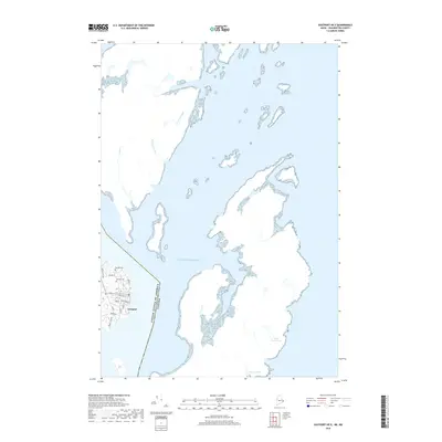
2018 Map of Eastport OE E
USGS Topo · Published 2018About this map
The coastal island city of Eastport serves as the focal point for this survey of Washington County's rugged eastern shoreline. Situated along the Atlantic Ocean, the map highlights the proximity of the international border between the United States of America and Canada. The local infrastructure of the settlement is detailed with a network of streets such as Boynton St, Water St, and High St. For genealogists and local historians, the inclusion of Hillside Cem and Bayside Cem provides valuable location data for historical research. Beyond the town center, the landscape is defined by coastal freshwater bodies like Whale Beach Pond and Eastern Pond, alongside small drainages including Leonards Brook and Mill Cr that feed into the surrounding saltwater channels.
Find a feature on this map
22 named features on this map. Tap any name to fly to it.
Don’t see what you’re looking for? This feature index may not catch every label — zoom into the map to look around manually.
Map Details
Editions of this 2018 Eastport OE E Map
This is the sole edition of this map. No revisions or reprints were ever made.
Other maps of this area

1907 · Eastport
USGS Topo · 1:48,000

1908 · Eastport
USGS Topo · 1:62,500

1929 · Robbinston
USGS Topo · 1:48,000

1931 · Robbinston
USGS Topo · 1:62,500

1943 · Eastport
USGS Topo · 1:62,500

1945 · Eastport
USGS Topo · 1:62,500

1949 · Robbinston
USGS Topo · 1:24,000

1949 · Eastport
USGS Topo · 1:24,000

1949 · West Lubec
USGS Topo · 1:24,000
1949 · Lubec
USGS Topo · 1:24,000