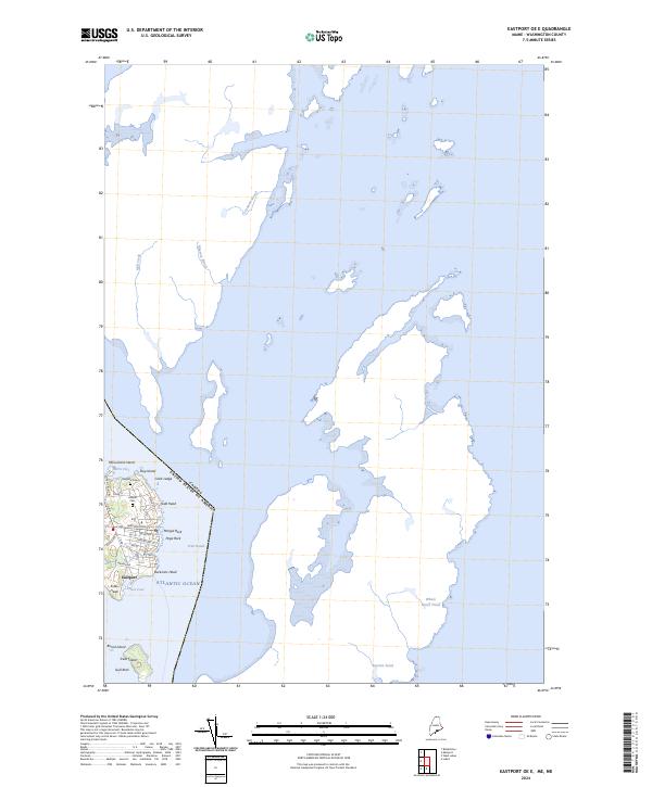
2024 Map of Eastport OE E
USGS Topo · Published 2024About this map
Eastport anchors the rugged coastal geography of Washington County, where the maritime border between the United States and Canada is defined by the deep waters of Friar Roads. This contemporary survey reveals an intricate network of island landmarks and tidal points, from the northern prominence of Monument Island down to Burial Island and Treat Island in the south. The street grid of the easternmost city in the U.S. is documented in detail, showing the layout of Washington St and Middle St as they approach the harbor at Prince Cove. Genealogists will find the locations of Hillside Cem and Bayside Cem clearly marked near the city's residential center. To the east, the landscape transitions to more isolated terrain, including the brackish environments of Eastern Pond and Whale Beach Pond, illustrating the persistent nautical character of this boundary region.
Find a feature on this map
36 named features on this map. Tap any name to fly to it.
Don’t see what you’re looking for? This feature index may not catch every label — zoom into the map to look around manually.
Map Details
Editions of this 2024 Eastport OE E Map
This is the sole edition of this map. No revisions or reprints were ever made.
Other maps of this area

1907 · Eastport
USGS Topo · 1:48,000

1908 · Eastport
USGS Topo · 1:62,500

1929 · Robbinston
USGS Topo · 1:48,000

1931 · Robbinston
USGS Topo · 1:62,500

1943 · Eastport
USGS Topo · 1:62,500

1945 · Eastport
USGS Topo · 1:62,500

1949 · Robbinston
USGS Topo · 1:24,000

1949 · Eastport
USGS Topo · 1:24,000

1949 · West Lubec
USGS Topo · 1:24,000
1949 · Lubec
USGS Topo · 1:24,000