
1947 Map of Eastport
USGS Topo · Published 1947About this map
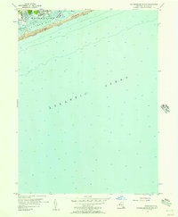
The coastal hamlets of southeastern Long Island are captured here just after the war, showing the intricate relationship between the marshy shoreline and the inland transport corridor. The Long Island Railroad and Montauk Highway serve as the primary east-west arteries, connecting the inland village of Eastport with shoreline communities like Speonk, Remsenberg, and Westhampton Beach. This era is defined by the transition from rural agricultural land to a more developed resort and residential landscape, evidenced by the presence of a Golf Course and a northern Airport with a noted Hangar.
Find a feature on this map
41 named features on this map. Tap any name to fly to it.
Don’t see what you’re looking for? This feature index may not catch every label — zoom into the map to look around manually.
Map Details
Editions of this 1947 Eastport Map
This is the sole edition of this map. No revisions or reprints were ever made.
Other maps of this area

1903 · Riverhead
USGS Topo · 1:62,500

1904 · Riverhead
USGS Topo · 1:62,500

1904 · Moriches
USGS Topo · 1:62,500

1943 · Riverhead
USGS Topo · 1:62,500

1947 · Mattituck
USGS Topo · 1:24,000

1947 · Riverhead
USGS Topo · 1:24,000

1947 · Quogue
USGS Topo · 1:24,000

1949 · New York
USGS Topo · 1:250,000

1954 · New York
USGS Topo · 1:250,000
1956 · Pattersquash Island
USGS Topo · 1:24,000