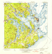
1943 Map of Eastport
USGS Topo · Published 1955About this map
Eastport and Lubec anchor this coastal landscape, situated along the complex maritime boundary between the United States and Canada. The map illustrates a region defined by its jagged coastline and deep-water passages, where the Maine Central RR connects inland settlements like Ayers Junction and Pembroke to the bustling port of Eastport. Large sections of the interior are dedicated to the Moosehorn National Wildlife Refuge, indicating the importance of conservation in this maritime environment.
Find a feature on this map
243 named features on this map. Tap any name to fly to it.
Don’t see what you’re looking for? This feature index may not catch every label — zoom into the map to look around manually.
Map Details
Editions of this 1943 Eastport Map
2 editions found

Other maps of this area

1907 · Eastport
USGS Topo · 1:48,000

1908 · Eastport
USGS Topo · 1:62,500

1917 · Cutler
USGS Topo · 1:62,500

1918 · Machias
USGS Topo · 1:62,500

1918 · Cutler
USGS Topo · 1:62,500

1929 · Calais
USGS Topo · 1:48,000

1929 · Robbinston
USGS Topo · 1:48,000

1931 · Robbinston
USGS Topo · 1:62,500

1932 · Calais
USGS Topo · 1:62,500

1941 · Machias
USGS Topo · 1:62,500