
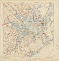
1945 Map of Eastport
USGS Topo · Published 1945About this map
Eastport serves as the focal point of this coastal survey, situated on an island landscape at the edge of the Grand Manan Channel. The intricate shoreline is defined by the deep indentations of Cobscook Bay and Passamaquoddy Bay, where the international boundary with Canada passes through the Friar Roads. Inland, the map reveals a mid-century infrastructure shaped by the Maine Central RR, which connects Ayers Junction to the coast.
Find a feature on this map
83 named features on this map. Tap any name to fly to it.
Don’t see what you’re looking for? This feature index may not catch every label — zoom into the map to look around manually.
Map Details
Editions of this 1945 Eastport Map
2 editions found
Other maps of this area

1907 · Eastport
USGS Topo · 1:48,000

1908 · Eastport
USGS Topo · 1:62,500

1917 · Cutler
USGS Topo · 1:62,500

1918 · Machias
USGS Topo · 1:62,500

1918 · Cutler
USGS Topo · 1:62,500

1929 · Calais
USGS Topo · 1:48,000

1929 · Robbinston
USGS Topo · 1:48,000

1931 · Robbinston
USGS Topo · 1:62,500

1932 · Calais
USGS Topo · 1:62,500

1941 · Machias
USGS Topo · 1:62,500