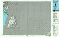
1986 Map of Eastport
USGS Topo · Published 1993About this map
Eastport and the surrounding maritime landscape of Washington County are defined by the complex waterways where the Quoddy River meets the Bay of Fundy. This mid-1980s topographic survey illustrates the tight geographical relationship between Maine and New Brunswick, showing the international boundary threading through the Grand Manan Channel and Lubec Channel. Notable coastal landmarks such as Buckman Head, Todd Head, and the Lighthouse at Quoddy Head State Park provide essential navigation points for the region's seafaring history.
Find a feature on this map
38 named features on this map. Tap any name to fly to it.
Don’t see what you’re looking for? This feature index may not catch every label — zoom into the map to look around manually.
Map Details
Editions of this 1986 Eastport Map
2 editions found
Other maps of this area

1907 · Eastport
USGS Topo · 1:48,000

1908 · Eastport
USGS Topo · 1:62,500

1917 · Cutler
USGS Topo · 1:62,500

1918 · Cutler
USGS Topo · 1:62,500

1929 · Robbinston
USGS Topo · 1:48,000

1931 · Robbinston
USGS Topo · 1:62,500

1943 · Eastport
USGS Topo · 1:62,500

1945 · Eastport
USGS Topo · 1:62,500

1949 · Robbinston
USGS Topo · 1:24,000

1949 · Eastport
USGS Topo · 1:24,000