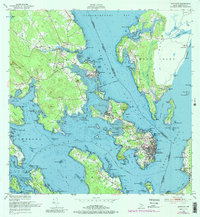
1949 Map of Eastport
USGS Topo · Published 1988About this map
The deep-water geography of the Passamaquoddy Bay region reveals a complex network of maritime and rail connections at the international border. The city of Eastport occupies a strategic position on the coast, served by the Maine Central railroad and the Eastport Municipal Airport. Across the Western Passage, the Pleasant Point Indian Reservation sits on the mainland, while the map extends across the boundary into New Brunswick to show Campobello Island and the village of Welshpool.
Find a feature on this map
125 named features on this map. Tap any name to fly to it.
Don’t see what you’re looking for? This feature index may not catch every label — zoom into the map to look around manually.
Map Details
Editions of this 1949 Eastport Map
4 editions found

Other maps of this area

1907 · Eastport
USGS Topo · 1:48,000

1908 · Eastport
USGS Topo · 1:62,500

1929 · Robbinston
USGS Topo · 1:48,000

1931 · Robbinston
USGS Topo · 1:62,500

1943 · Eastport
USGS Topo · 1:62,500

1945 · Eastport
USGS Topo · 1:62,500

1949 · Robbinston
USGS Topo · 1:24,000

1949 · Whiting
USGS Topo · 1:24,000

1949 · Pembroke
USGS Topo · 1:24,000

1949 · Red Beach
USGS Topo · 1:24,000